About Bloor Homes
Bloor Homes is a family-owned private housebuilder with a reputation for quality, consistently achieving the highest five-star rating for customer satisfaction in the annual National Housebuilders Federation National New Homes Customer Satisfaction Survey. Over 97% of our customers would recommend us to family and friends.
Find out more at: https://bloorhomes.com/
The site
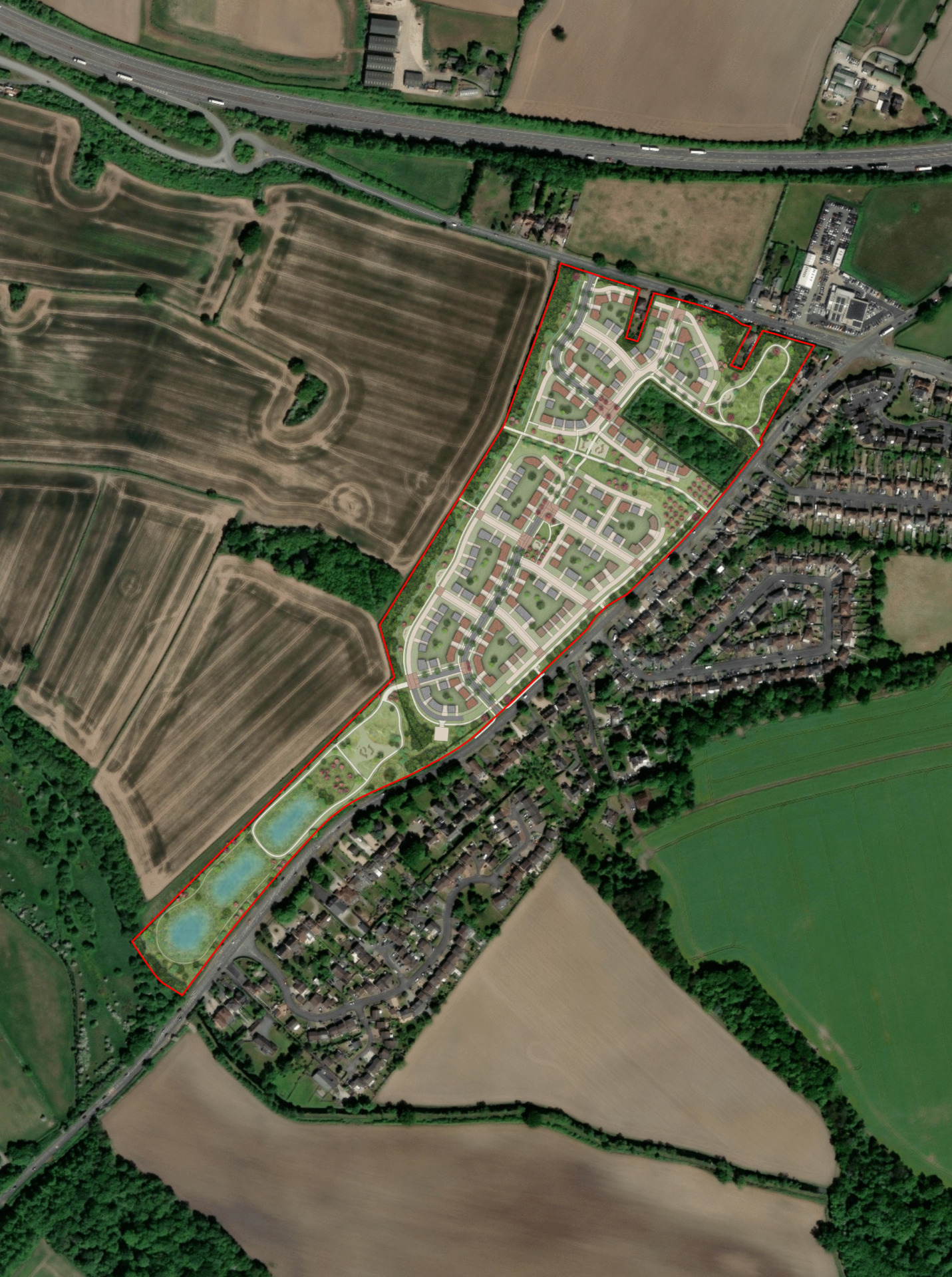
The circa 14 hectare (ha) is located on the western edge of Mile Oak. It is located on the west side of Sutton Road which runs alongside the eastern boundary of the site, and on the south side of Hints Road.
The site is currently in agricultural use, comprising a number of fields which have relatively low biodiversity value. Higher value habitats of hedgerows and trees form the boundaries, including an area of woodland adjacent to Sutton Road. It is intended that these higher value habitats will be retained and enhanced with extensive additional planting.
The site is currently designated as Green Belt, however due to recent national planning policy changes, it is now being brought forward as a sustainably located grey belt site to meet increased housing need.
Surrounding uses to the east of the site are largely residential, comprising the built form of Mile Oak that has developed along the B5404 Watling Street and A453 Sutton Road. Whilst the surrounding area to the north, south and west of the site are largely in agricultural use, there are two clusters of dwellings and employment units including a car dealership to the north of Hints Road. Similarly, there is an isolated employment development located off Roman Road to the west and a large farmstead beyond that.
A public right of way runs through the site southwards from Hints Road, before turning westwards to link to Bourne Brook. This public right of way will be retained, with a new network of walking routes within landscaped public open space providing connections to it.
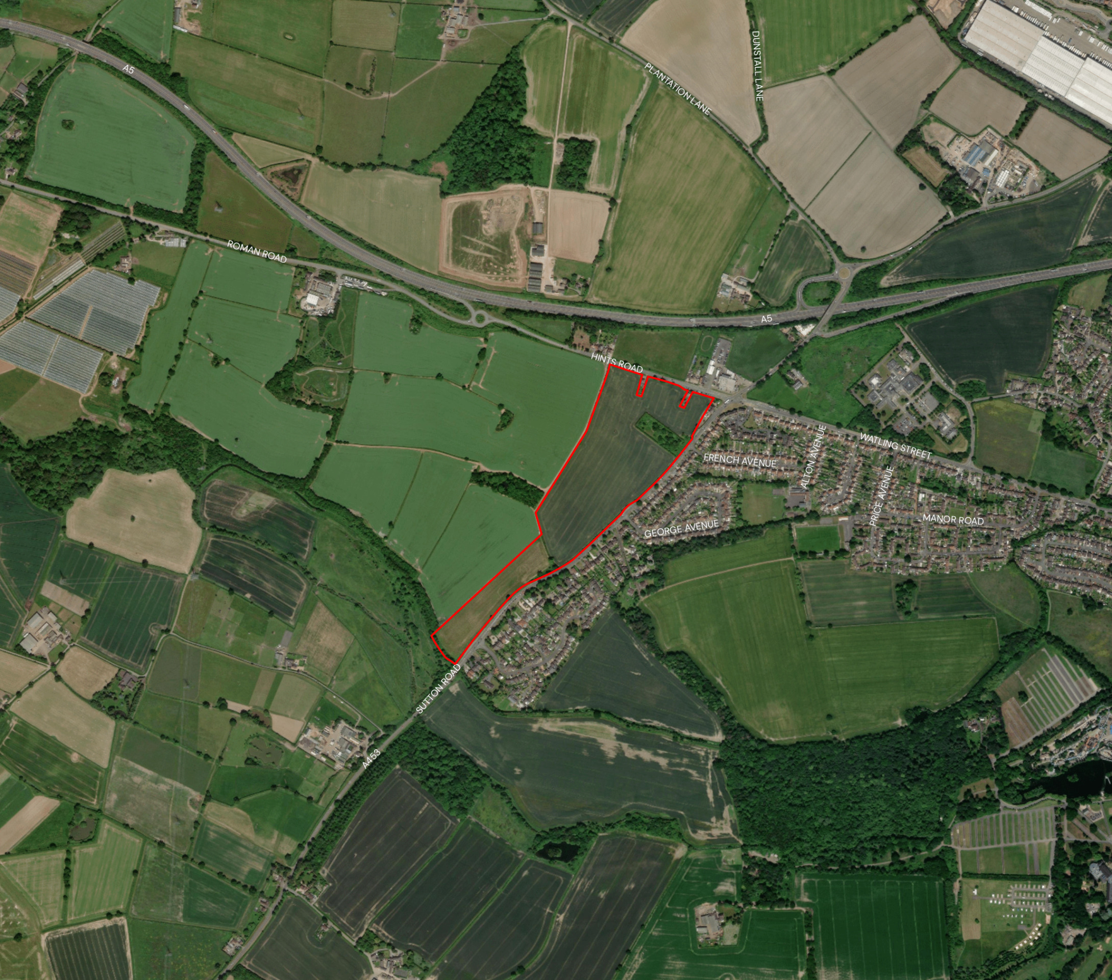
Site location plan - click to enlarge
Planning policy context
Increased housing targets for Lichfield District
The site has been promoted through Lichfield District Council's emerging Local Plan. However, there have been delays with the production of the Local Plan, a previous draft of which was withdrawn from examination in October 2023, with Lichfield District Council restarting the preparation of a new Local Plan.
Lichfield District Council's Strategic Housing Land Availability Assessment (SHLAA) assesses the site as “Suitable”, “Available” and “Achievable”.
Since the Local Plan process was restarted, the government introduced a new National Planning Policy Framework (NPPF) in December 2024. This has significantly increased the number of homes that need to be delivered in Lichfield District from 289 to 753 new homes per annum.
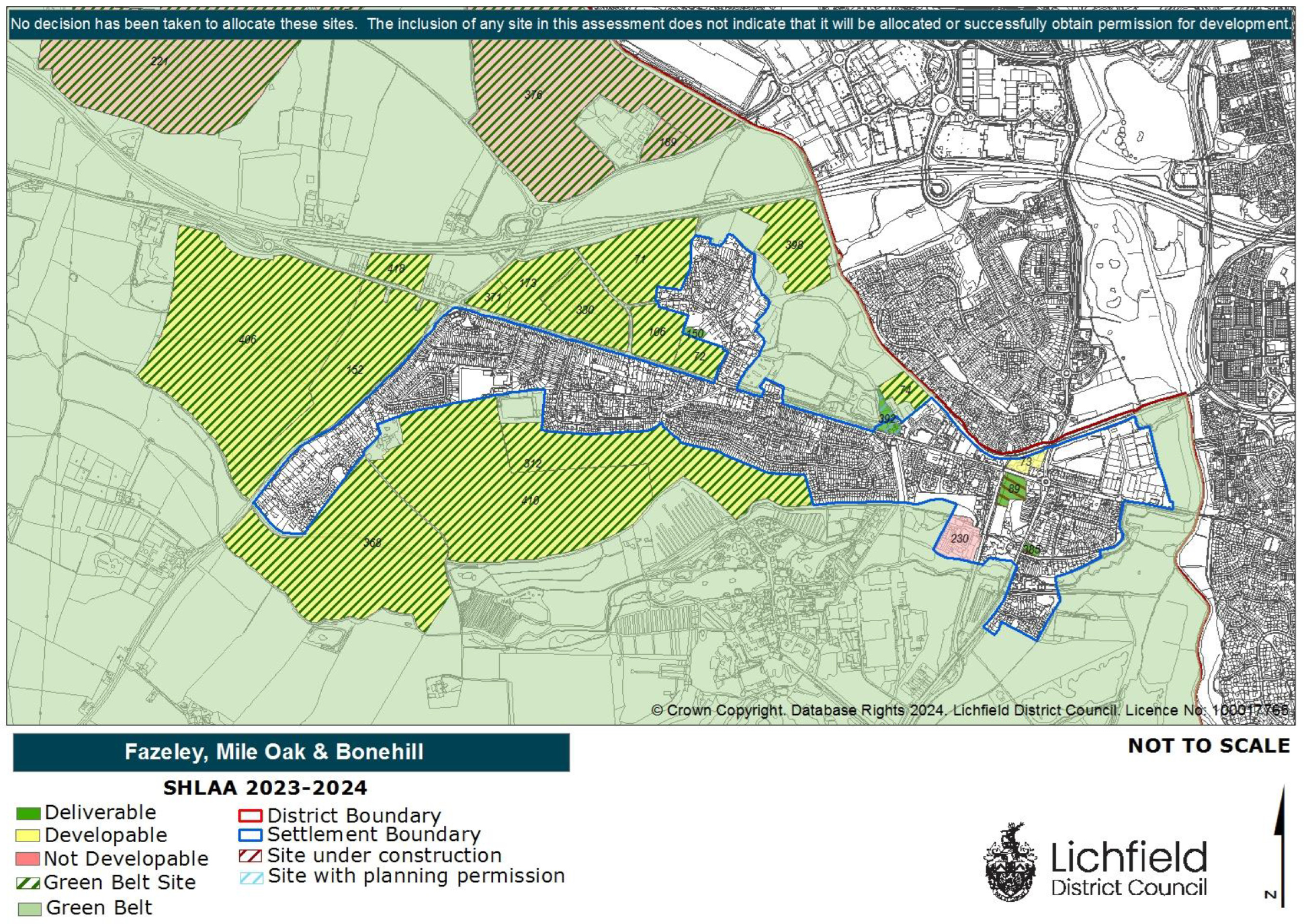
An extract from Lichfield District Council Strategic Housing Land Availability Assessment which assesses the site (152) as being “Developable”.
Grey belt
A new grey belt policy was also introduced in the NPPF. This allows development in some areas of green belt, provided certain criteria are met. Grey belt includes land that ‘does not strongly contribute’ to green belt purposes which are set out in the NPPF. The site at Mile Oak is sustainably located on the settlement edge, with existing development to the east and north. It meets the criteria for grey belt land and is being brought forward for a sensitive, landscape-led sustainable residential development on this basis.
Five-year housing land supply
The new NPPF also requires that Lichfield District Council is able to demonstrate a five-year housing land supply. This is the amount of land that the Council must identify to ensure there are sufficient deliverable sites for residential development over the next five years. Lichfield District Council currently cannot demonstrate a five year supply of deliverable housing land. In light of this, an outline planning application for grey belt land at Mile Oak will help to contribute to meeting this housing delivery shortfall at a sustainable location.
An outline planning application establishes the broad principles of development, such as access arrangements, illustrative concept layout, number of homes and general extent of development.
If outline planning consent is granted, a detailed planning application called a “reserved matters” planning application would be prepared. This would include more detail such as architecture, materials, detailed layout and landscaping, and would be subject to further consultation with the local community before being submitted for determination. Both outline and reserved matters planning applications are subject to Statutory Consultation carried out by the Local Planning Authority (Lichfield District Council).
Site constraints and opportunities
How local features and landscape have shaped the proposed illustrative layout of the new neighbourhood.
In preparing the concept layout for the site, the technical team appointed by Bloor Homes first of all considered the landscape, drainage features, topography and local context of the site. The following plan shows some of the features and constraints that have informed the emerging outline proposals. Key features include a public right of way running along the western boundary of the site, existing residential development to the east and residential parcels to the north, a listed milestone on Sutton Road, and an area of woodland within the site adjacent to Sutton Road (this will be retained).
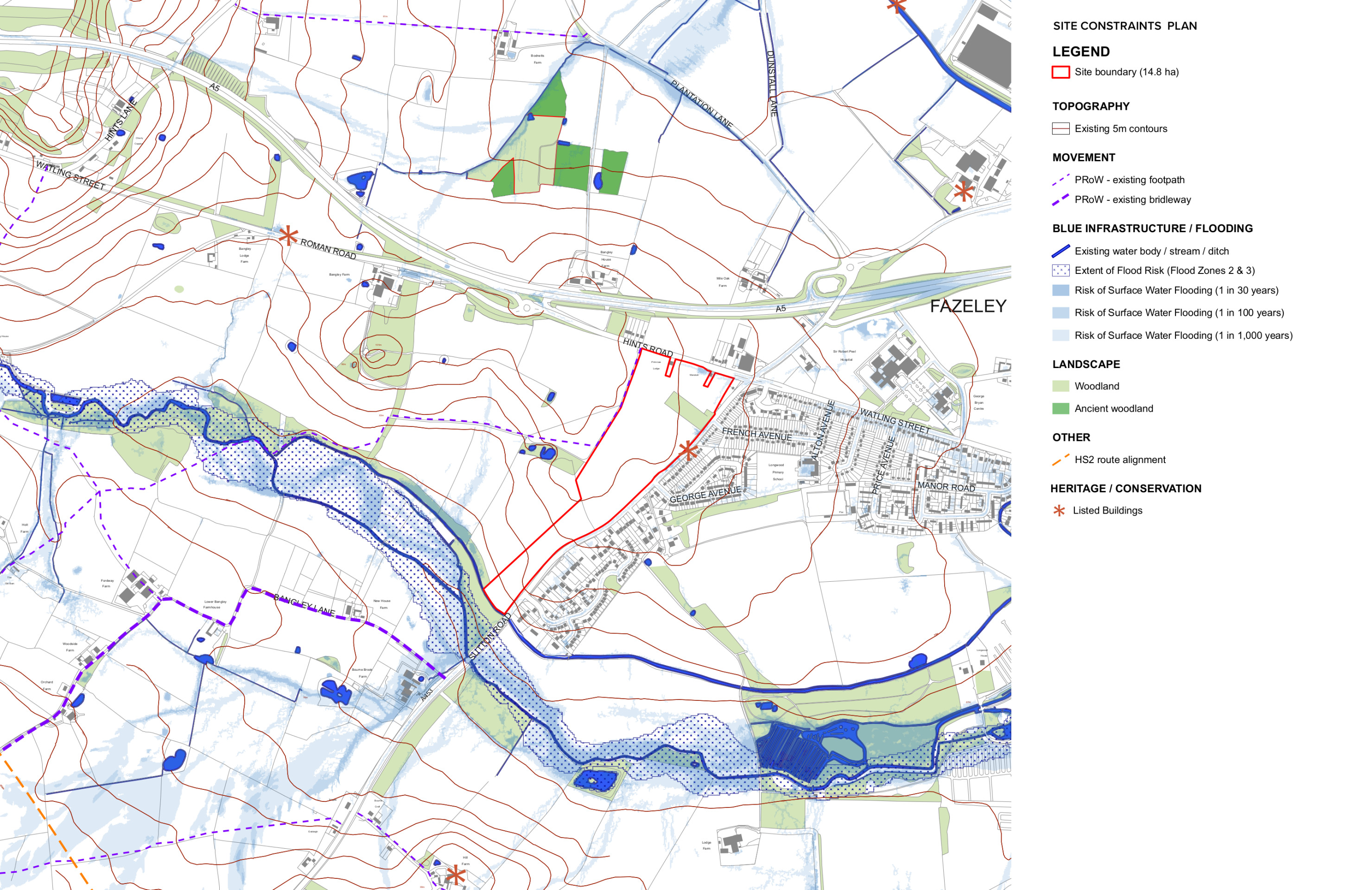
This plan shows analysis of some of the site features that have influenced the illustrative masterplan for the new neighbourhood - click to enlarge
The emerging proposals
Following community consultation during the summer of 2025, family-owned, five-star housebuilder, Bloor Homes, has submitted outline proposals for a residential neighbourhood at a sustainable location on the edge of Mile Oak.
The proposed new neighbourhood would include:
- Up to 250 high-quality family and affordable homes.
- Up to 50% would be affordable, including shared ownership homes for first time buyers.
- Potential to provide accessible homes or bungalows as part of the housing mix.
- A gas-free development with all homes built to be net zero carbon-ready, including air source heat pumps, solar panels, uprated insulation and EV charging infrastructure.
- A landscape-led approach to development, with the retention of existing woodland and the majority of hedgerows, alongside extensive planting of new trees and woodland areas.
- Extensive public open space, including a network of walking and cycling routes linking with existing public rights of way.
- A submitted scheme that aims to resolve long-standing issues at Mile Oak crossroads, enhancing a previously committed scheme and unlocking its delivery to improve highways safety in Mile Oak.
- The potential to reduce speed limits on Sutton Road and Hints Road in ongoing liaison with the local highways authority.
- The provision of a new toucan crossing on Sutton Road.
- A children’s play area for new and existing residents.
- Community orchards and areas of biodiversity enhancement.
- Bird nesting bricks or boxes in every new home and hedgehog highways between gardens.
- A package of investment to support local services, to be determined in consultation with statutory consultees such as the local NHS Integrated Care Board, education and highways authorities, and others.
Illustrative masterplan
The image opposite shows an illustrative masterplan of the proposed new neighbourhood. You can view the masterplan in more detail on our interactive map by clicking on the image or by following this link.
The site will have two independently accessed areas with the northern parcel served off an access from Hints Road and the southern parcel with an access from Sutton Road. It is currently proposed that there would be no vehicular link between the two. The two residential areas will be served by a central area of multi-functional open spaces accessed via the network of active travel routes throughout the site.
As shown on the masterplan, the southwestern, narrower part of the site, would contain the sustainable drainage features where the land levels are lowest. There is a veteran tree located within this area and this would be protected. The green infrastructure in this area would create an attractive buffer to the site, and connect into the wider site by green corridors which lead through the scheme and along its boundaries. This would also incorporate and enhance the existing public right of way along the boundary of the site.
The illustrative masterplan of the proposed new neighbourhood. Please note that this is subject to change in response to ongoing technical work and consultation feedback. Click image to open interactive map.
New homes
House types
The planning application is an outline planning application. This type of planning application sets out the broad principles of development, such as maximum number of homes, an illustrative layout and site access arrangements. Should outline planning permission be received, finer details such as specific house types, detailed layout, architecture etc would be subject to a subsequent further planning application (called a reserved matters planning application). This would involve further consultation with the community.
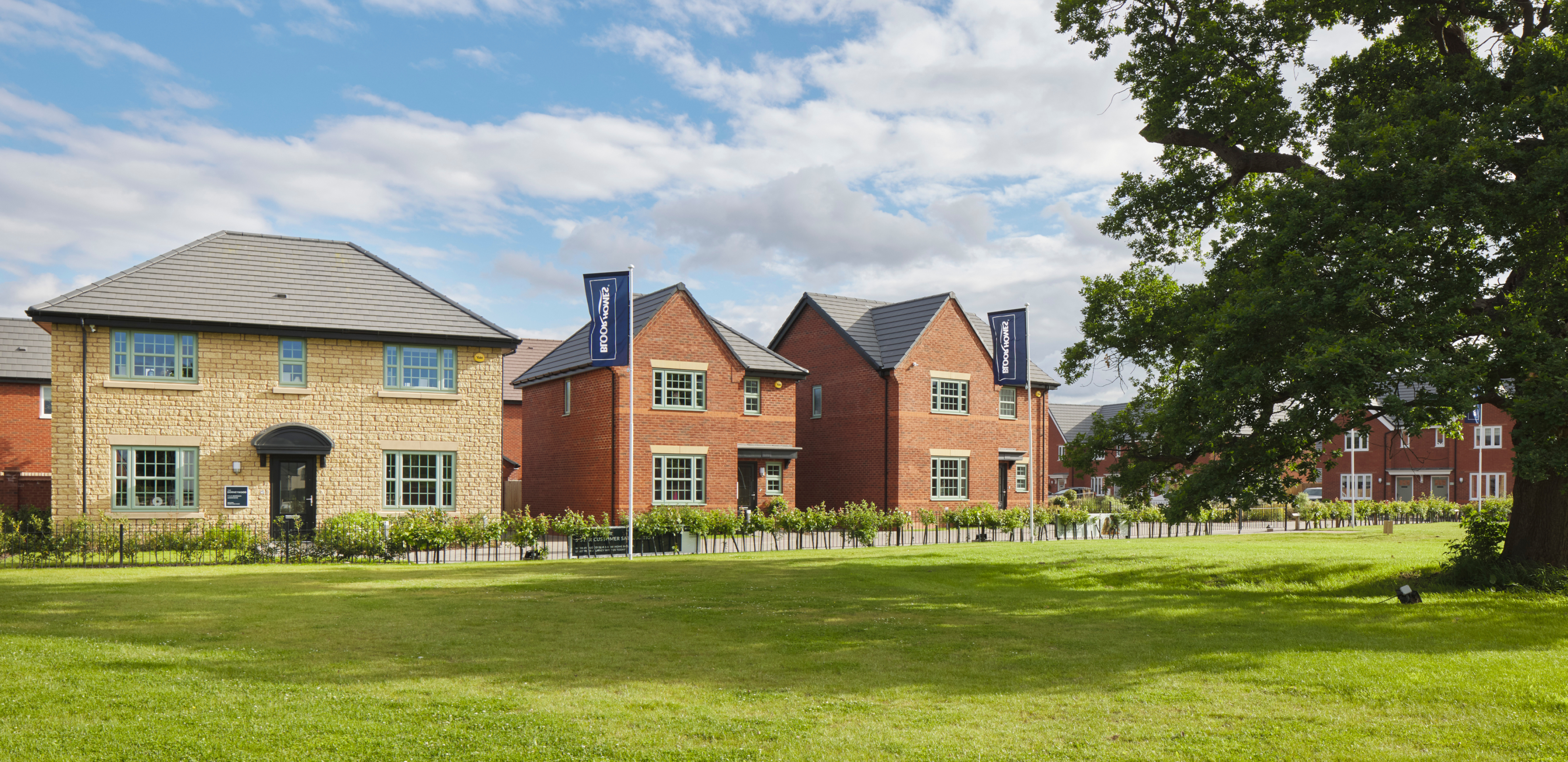
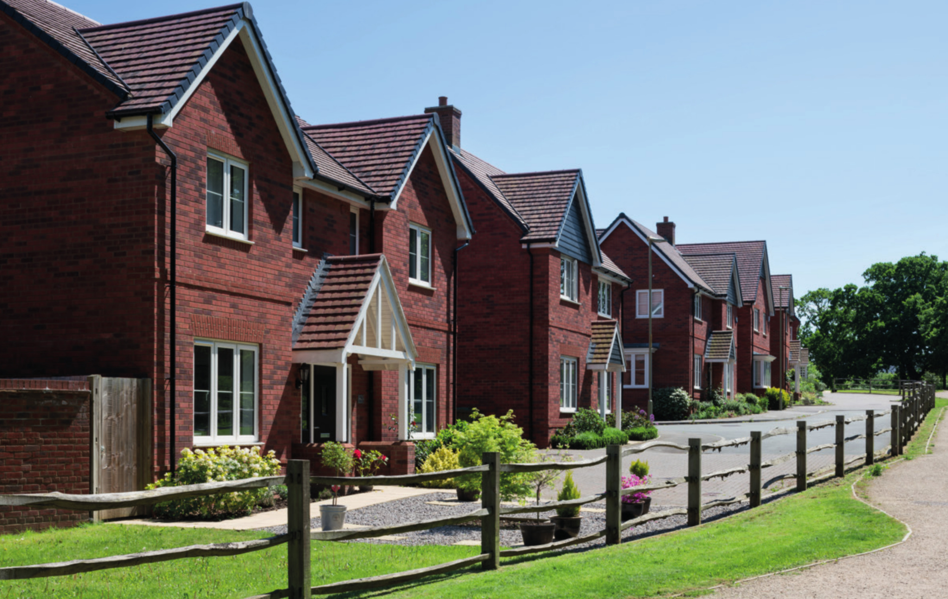
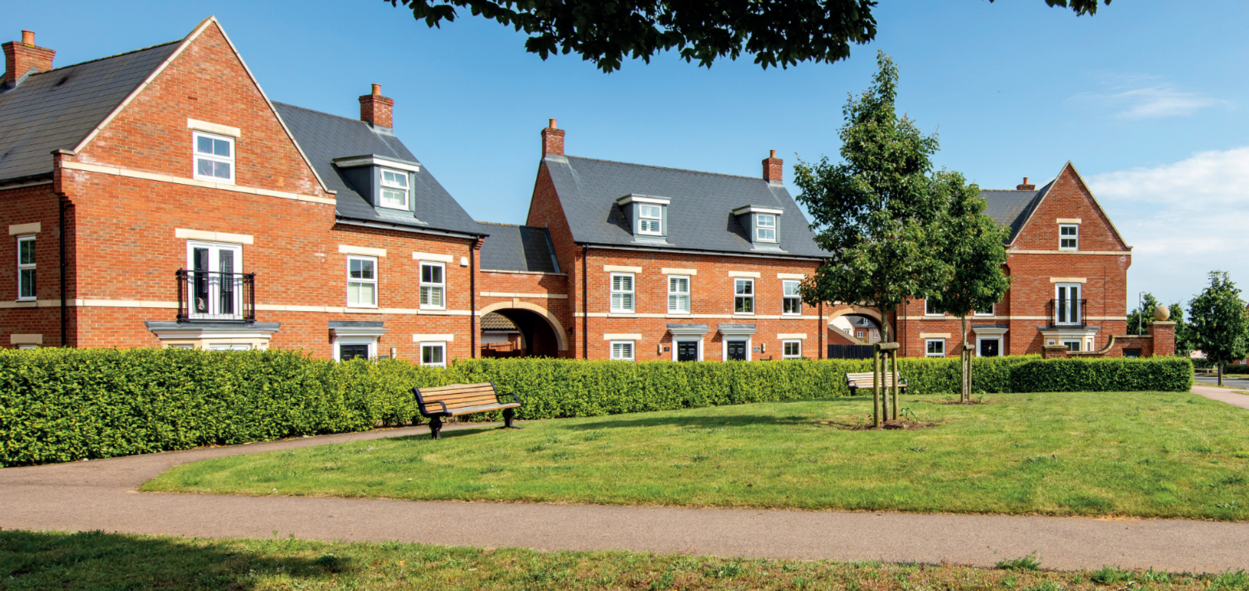
While house types would be determined at the reserved matters planning stage, we have provided imagery of existing Bloor Homes developments on this website to provide an idea of the types of high-quality homes we build. Click on the adjacent image to open a gallery of examples of existing Bloor Homes developments.
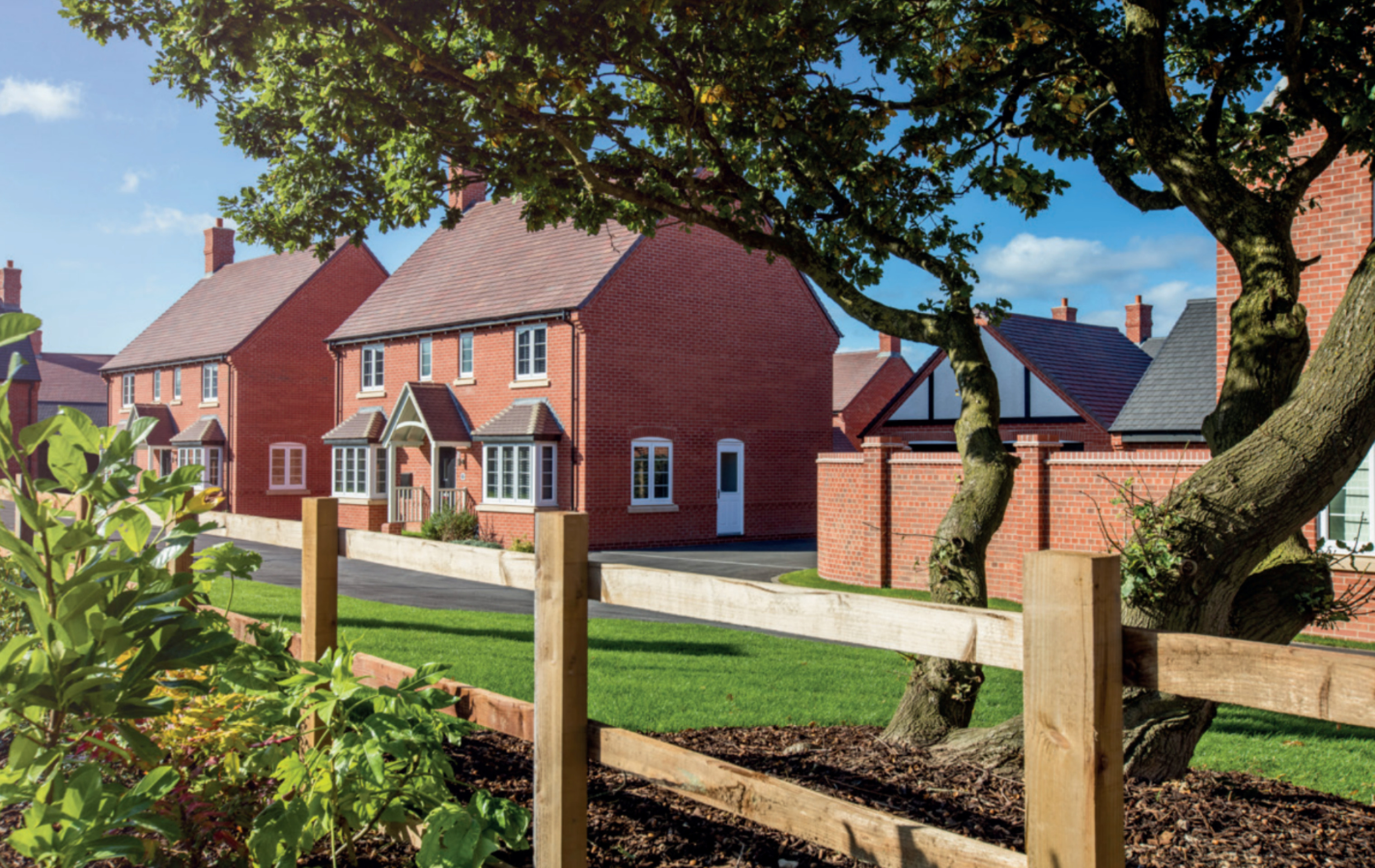
Examples of some recent Bloor Homes developments. Click to open a gallery of images.
Affordable homes
As the site is being proposed for development as a grey belt site, up to 50% of the new homes would be classified as affordable homes in line with national policy. This will provide opportunities for those on lower incomes with connections to the local area to secure a home of their own. Affordable housing is anticipated to be provided in a mix of affordable rent and shared ownership homes aimed at first time buyers. However, this will be determined in consultation with Lichfield District Council’s Housing Team.
We are happy to work with Lichfield District Council for Local Occupancy Criteria to be applied to the affordable housing provision, ensuring that it is prioritised for people with local connections if this is a priority in community feedback.
Sustainable homes
We want to deliver homes that are sustainable now and contribute to a cleaner, greener future.
We know that sustainability is hugely important to communities across the country. The new homes at Mile Oak would be built to the Future Homes Standard, resulting in a neighbourhood of net zero carbon-ready homes.
The neighbourhood will be gas-free, with all homes provided with air source heat pumps as standard. Solar panels will also be incorporated, which along with the use of the latest materials and technique to maximise insulation, air tightness and heat recovery, will create an uplift in energy efficiency of 75-80%.
The new homes will incorporate sanitaryware and appliances that meet the highest water efficiency standards.
Electric vehicle (EV) charging points will be provided for all homes with on plot parking, together with access to communal EV charging points for the whole neighbourhood.
To minimise the impact of construction, we always aim to procure materials from sustainable sources and recycle construction waste as far as is possible.

The new homes for MIle Oak will be net zero carbon ready
Investing in local services
A key consideration with a planning proposal such as this is to ensure that local services receive the investment they need to accommodate housing growth in the local area. The development will generate investment into local infrastructure such as healthcare and education, and this will be informed by consultation carried out by Lichfield District Council with statutory bodies such as the local NHS Integrated Care Board and the local education authority and will be secured via legal agreement between Bloor Homes and the Council.

The development will generate significant funding for key infrastructure such as healthcare and education, to be determined in consultation with bodies such as the NHS, local education authority, etc
Access and connectivity
Connectivity
The site is very well located for easy access to a number of local services within a short walk, including a local convenience store on the crossroads to the northeast, Mile Oak village hall, Longwood Primary School and Sir Robert Peel Community Hospital.
There are a number of other facilities located in the adjacent local centres, such as a food retail at Ventura Retail Park, as well as a variety of facilities and services in Fazeley and Tamworth.
The site benefits from excellent public transport connectivity, with a number of bus stops located immediately adjacent to the site’s eastern boundary and within a short walk to the east of the A453 / B5404 crossroads. Those services provide access to Tamworth, Atherstone, Sutton Coldfield and Nuneaton. The site is also located in reasonable proximity of Tamworth and Wilnecote Train Stations; which themselves provide local services to Birmingham, as well as cross-country services to major cities.
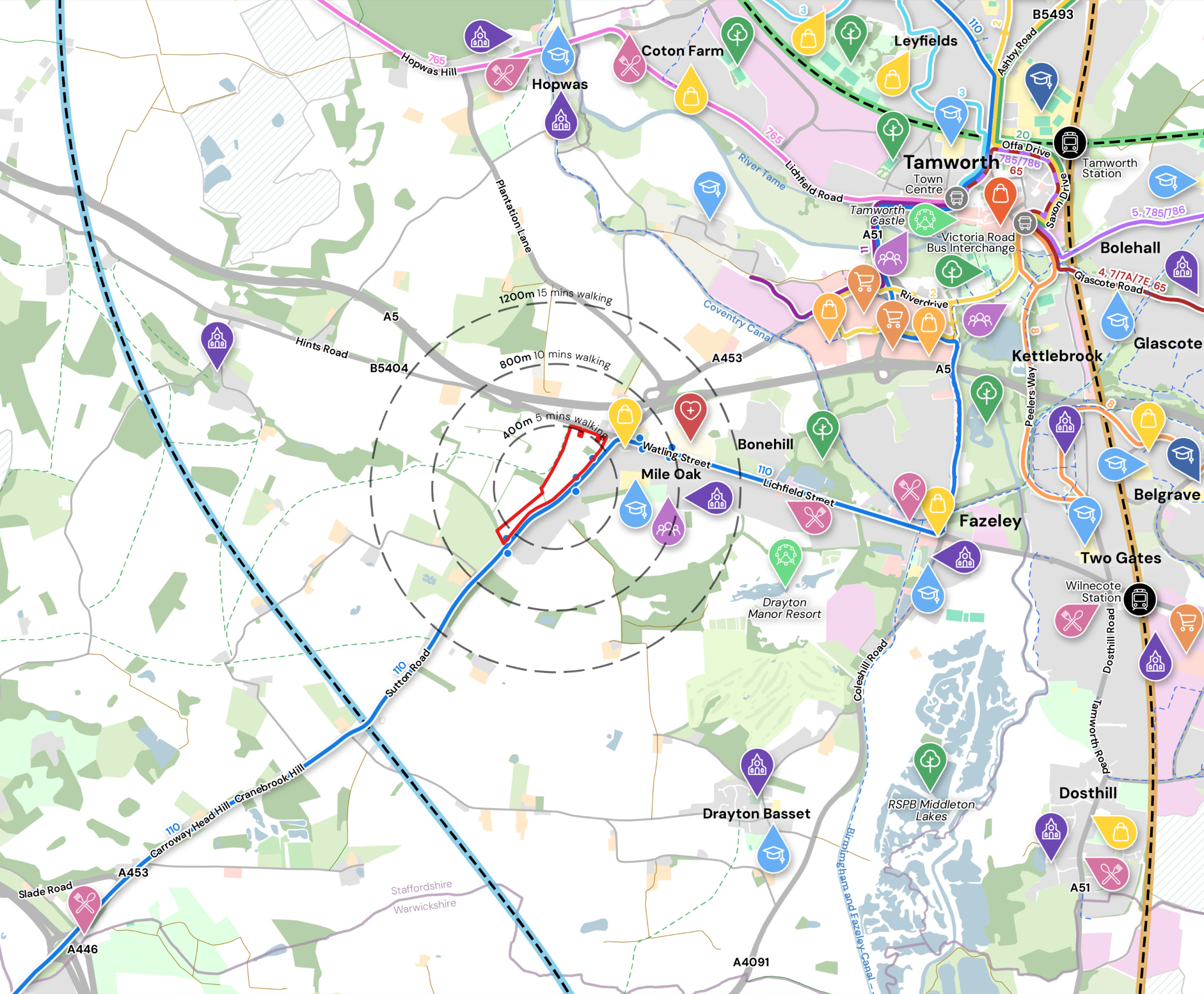
Facilities and movement plan – This plan shows the location of the site in relation to a range of local facilities and public transport routes (such as the bus route shown in blue adjacent to the site). Click to enlarge.
Site access
The southern parcel of the development will be accessed via a ghost-island right turn junction off Sutton Road. The smaller northern parcel will be accessed via a single ghost-island right turn junction from Hints Road. It is currently proposed that there would be no vehicular access between the two parcels, only pedestrian, cycle and emergency access.
Both access junctions will be designed in accordance with the parameters set out in Staffordshire County Council’s Residential Design Guide (RDG) for a ‘Major Residential Access Road’, comprising a 5.5m carriageway on the minor arm, along with 10m junction radii and 2m footway provision along both sides of the carriageway. The junctions will be accompanied by uncontrolled pedestrian crossing facilities in the form of dropped kerbs and tactile paving, along with a kerbed central pedestrian refuge facility, in order to tie into the existing footway provision on the opposite side of Sutton Road.
Potential speed limit reductions/extensions and toucan crossing
It is envisaged with the increase in pedestrian and cycle movements on Sutton Road and Hints Road, that a number of interventions could be implemented to ensure pedestrian safety. There is the potential that the existing 40mph speed limit on Sutton Road could be reduced to 30mph along the entire site frontage, subject to ongoing liaison with the local highways authority. This could be reinforced with new gateway features to the south, incorporating signage and road markings, as well as the potential for a Speed Indication Device.
The primary desire line from the site is envisaged to be to the east, along French Avenue and Watling Street where a range of facilities and amenities can be accessed. In order to support pedestrian and cycle access into the site from the east, the delivery of a toucan crossing facility (signal controlled crossing for pedestrians and cyclists) on Sutton Road is proposed as part of the outline proposals. The proposed location for this toucan crossing is indicated on the interactive masterplan.
On Hints Road, there is potential that the existing 40mph speed limit could be extended along the site frontage (currently national speed limit). This is again subject to ongoing liaison with the local highways authority. The new posted speed limit could be accompanied by gateway features, such as markings on the carriageway and Virtually Assisted Signs to notify drivers of the speed at which they are travelling, followed by interactive measures, for example “please slow down”. Such measures would help alert drivers that they are entering a residential area.
The proposals include the delivery of a toucan crossing on Sutton Road alongside a speed limit reduction, to facilitate safe movement of pedestrians and cyclists.
Mile Oak crossroads
We are aware of long-standing concerns locally in relation to Mile Oak crossroads, and also of the committed scheme of improvements that have been previously agreed by the local highways authority and are awaiting delivery. We have submitted proposals to enhance this previously committed improvement scheme, and we will continue to work with the local highways authority so that our proposed development can help to resolve these long-standing concerns and unlock the delivery of improvements to highways safety in Mile Oak.
Transport Assessment and Travel Plan
Traffic surveys have been undertaken as part of the ongoing promotion of the site through the Lichfield District Local Plan in liaison with Staffordshire County Council, the local highways authority. A full suite of surveys and traffic impact assessments is presented in a Transport Assessment that forms part of the outline planning application.
The planning application is also accompanied by a Travel Plan to ensure the efficient operation of the site. This includes measures to encourage sustainable travel from the onset of the occupation, as well as suggested ongoing monitoring procedures.
Green infrastructure
We want to ensure that natural habitats are protected while we deliver new homes for people and families.
We are conscious of the ever-increasing importance of ensuring that development is sustainable, protecting and enhancing natural habitats and green infrastructure as much as possible whilst delivering much needed homes for people and families.
The provision of high-quality green public open spaces is at the heart of the landscape-led approach to sensitive development at Mile Oak. Existing mature trees including an area of woodland adjacent to Sutton Road, and the majority of hedgerows, will be retained. Alongside this extensive additional planting and new woodland creation will deliver a significant increase in tree cover across the site.
The new neighbourhood will feature extensive green public open spaces, including a central green corridor between the two parcels of development, a large public open space in the northeastern corner of the site, and the southern portion of the site retained as open space including wetland habitat. A network of walking and cycling routes linking with existing public rights of way will be set within these landscaped open spaces, as well as features including a children’s play area for new and existing residents, community orchards, and areas of biodiversity enhancement.
Ecology
Specialist environmental consultants have been appointed to undertake ecology work in support of the outline planning application. The site is not covered by any statutory ecological designations (Local/National Nature Reserves, Ramsar Sites, Sites of Special Scientific Interest, Special Protection Areas, and Special Areas of Conservation), nor is it subject to local planning designations. The site falls outside the River Mease catchment and outside the Impact Risk Zone (IRZ) associated with the Middleton Pools SSSI.
The north of the site comprises intensively managed arable land, whist the southern field parcel consists of modified grassland, both of which have relatively low intrinsic ecological value. Of greater value as habitats are the veteran trees, broadleaved woodland, and hedgerows within the site, all of which will be retained and enhanced with additional planning.
The outline planning application is supported by relevant ecology surveys and report, and it is anticipated that development will deliver at least 10% biodiversity net gain.

Homes for Nature
Bloor Homes is proud to be a member of the Homes for Nature programme. This will see the installation of nesting bricks/boxes in every new home and hedgehog highways between gardens.

Drainage
Bloor Homes has appointed specialist consultants to undertake technical work on flood risk and drainage matters.
The Environment Agency’s Flood Map for Planning confirms that the entire site is located within Flood Zone 1 and therefore has the lowest probability of flooding (less than a 0.1% annual chance).
In terms of surface water drainage, there are limited areas of surface water flood risk within the site, with development being directed to areas with the lowest risk of surface water flooding. Surface water on the site will be managed with a sustainable drainage system (SuDS). This is anticipated to include attenuation basins, swales, filter drains and strips, and permeable paving.
Not only will the sustainable drainage system improve surface water drainage on the site, but it will also provide a biodiversity benefit through the creation of new wetland habitats associated with the attenuation basins and swales.
More details about the surface water drainage strategy are provided in an Outline Surface Water Drainage Strategy and Flood Risk Assessment submitted as part of the planning application.
The sustainable drainage system for the new neighbourhood will also provide biodiversity benefits through the provision of wetland habitat.
Other technical considerations
Landscape
A comprehensive Landscape and Visual Appraisal has been prepared to accompany the outline planning application. The site does not have any landscape designations, and any local landscape impacts can be effectively mitigated through the landscape-led, sensitive approach to the masterplan proposed for the new neighbourhood.
A Landscape and Visual Impact Assessment has been undertaken, and has informed the evolution of the Masterplan. It finds that, given the proximity of existing footpaths, there will be impacts on the existing views from those locations, but that impacts on more distant views will be less significant; particularly after 15 years once the proposed planting will have reached maturity.
Archaeology/Heritage
An Archaeology and Built Heritage Assessment has been prepared by specialist consultants to be submitted as part of the planning application
No statutory designations in the form of Scheduled Monuments are located in the vicinity of the site or the wider area. As such the assessment has not identified any designated archaeological assets which will be negatively impacted by the proposed development.
While the proposed development will bring a visual change and a change in the landscape character within the site, it is considered that this change will bring no harm to the significance of the Grade I listed Church of St Editha, located circa 1.8 miles to the northeast of the site, and the Grade II listed Milepost located adjacent to the eastern site boundary on Sutton Road.
The proposed development will bring no harm to the significance of the Fazeley and Bonehill Conservation Area, located over 900m to the northeast of the site or the Hints Conservation Area, around a mile to the west of the study site. In addition, it is not considered that the development would impact the relative significance of the non-designated Beacon House.
On the basis of the known information, the archaeological potential of the site is not considered to be sufficient to constrain development. In line with national and local policy, a requirement for archaeological investigation comprising geophysical survey and evaluation trial-trenching is anticipated to confirm the absence of significant archaeological deposits.
Other studies
Other technical reports submitted with the outline planning application cover matters such as arboriculture (trees), noise, air quality and others.